The Landing Pin Is an Estimate
Predicts where a high-altitude balloon flies and where it comes down, then hands you the track for ATAK. Estimates only.
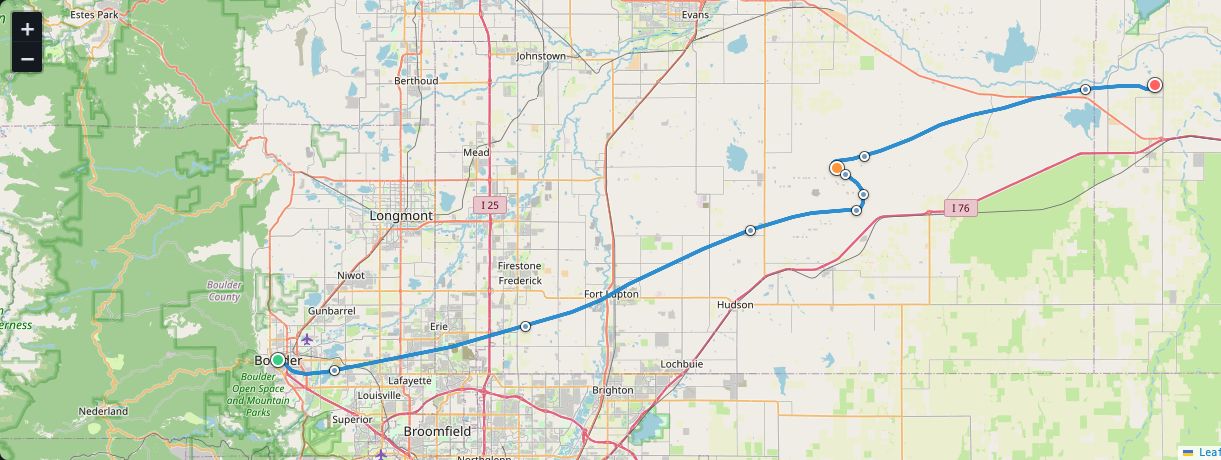
Pick a launch point, an ascent rate, a burst height and a parachute. This flies the balloon through tomorrow's winds and puts a pin where it thinks the payload comes down. Then it hands you the track as KMZ, KML or GPX for ATAK.
Try it in the browser — no install. Your browser talks to SondeHub's free predictor itself, so where you fly never reaches my server. Estimates only, never for regulatory use. Recovery can miss by many kilometres. The desktop tool adds multi-day forecast scans, saved missions and wind profiles shared from Windmaster; this has none of them.
Descent rate is not how fast it is falling
The number the predictor wants for descent is the sea-level equivalent terminal rate of the parachute, not the instantaneous sink at 80,000 feet. Feed it the high-altitude number and the landing walks miles.
The winds are NOAA GFS, most reliable about zero to seven days ahead. Days eight through fourteen can be selected and often have no dataset yet. When there is no wind file for that launch time, there is no answer — not an empty track dressed up as a prediction.
A timestamp with no time zone is UTC. Read it as the viewer's local time and the whole flight silently shifts by however many hours you are from Greenwich. The desktop tool labels that field UTC and then parses it as local. The preview does not copy that.
Two longitude ranges, one date line
The predictor wants longitude in 0–360. Everything else on this site uses −180 to 180. Colorado at 105.27° west is 254.73° on the way in and has to come back as 105.27° west on the way out. Minus 180 maps to plus 180. A one-line remainder does not do that, so the conversion is a loop.
Burst is the last point of ascent, once. The descent segment starts at its second sample so the join is not drawn twice. A float flight that never comes down has no landing waypoint at all — that is reported, not invented.
A flight that crosses the date line has to be split wherever consecutive longitudes jump more than 180°. The exports do that. The map in the preview does not: it draws one straight line across the world. That is written on the page because a track that looks like a great-circle to the opposite ocean is worse than a gap.
Every waypoint description says estimate only. The landing one says it is not for filings, NOTAMs or life-safety. Those sentences are load-bearing. They travel with the file into ATAK, so a tablet that never saw this site still gets the warning.
The pin is a place to start looking, not a place to stand.
If you want winds you can believe at the altitudes a balloon actually uses, that is Windmaster. This only asks where those winds would take one flight, on one day.

Comments